

Wind and rain is forecast to ravage the UK on the first Friday that people have been allowed to meet in large groups outside in England, with a yellow weather warning in place in the capital.
London is currently experiencing extremely strong winds, and the Met Office has issued a weather warning running until 9pm tonight.
They warn that windy weather may cause travel disruption and even damage to weak outdoor structures. The Dartford Crossing has already been forced to close due to high winds.
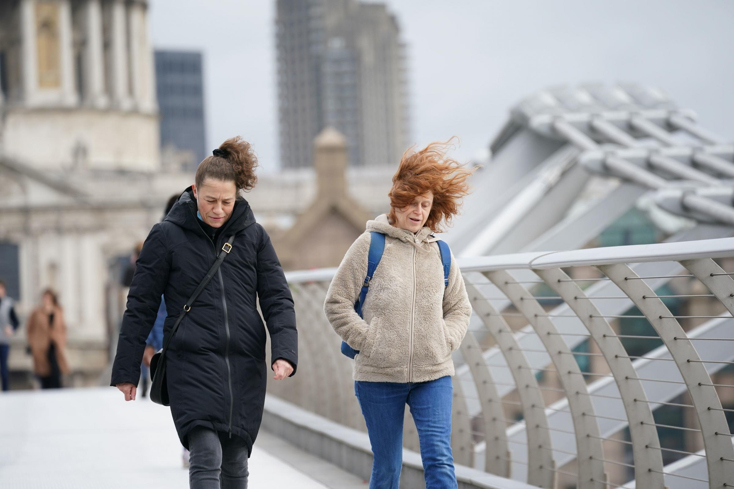
The Millenium Bridge, London. Yui Mok/PA Wire
And forecasters predict a strong possibility of regular rainfall and even more stormy weather over the next few days in the capital.
Met Office meteorologist Aidan McGivern has described the outlook across the nation as a "showery situation" on Friday and Saturday, with drier weather on the horizon by Sunday.
A yellow weather warning for winds which could cause travel disruption is in place for the south-west corner of England from 3pm on Friday, with 60mph gusts expected on the coast.
Mr McGivern said Friday promises rain and wind for all parts of the nation.
He said: "It's going to be a wet and windy start for many on Friday morning.

Danny Lawson/PA Wire.
"The heaviest rain will be in north-west England, parts of Wales, and then increasingly the South West, the Midlands and the rain reaching the South East by the end of the afternoon as a showery situation develops.
"Eastern Scotland as well as north-east England stays dull and damp throughout much of the day - and with the wind in the North East it's going to feel raw."
Forecasters have predicted up to 100mm of rainfall on higher ground in Wales.
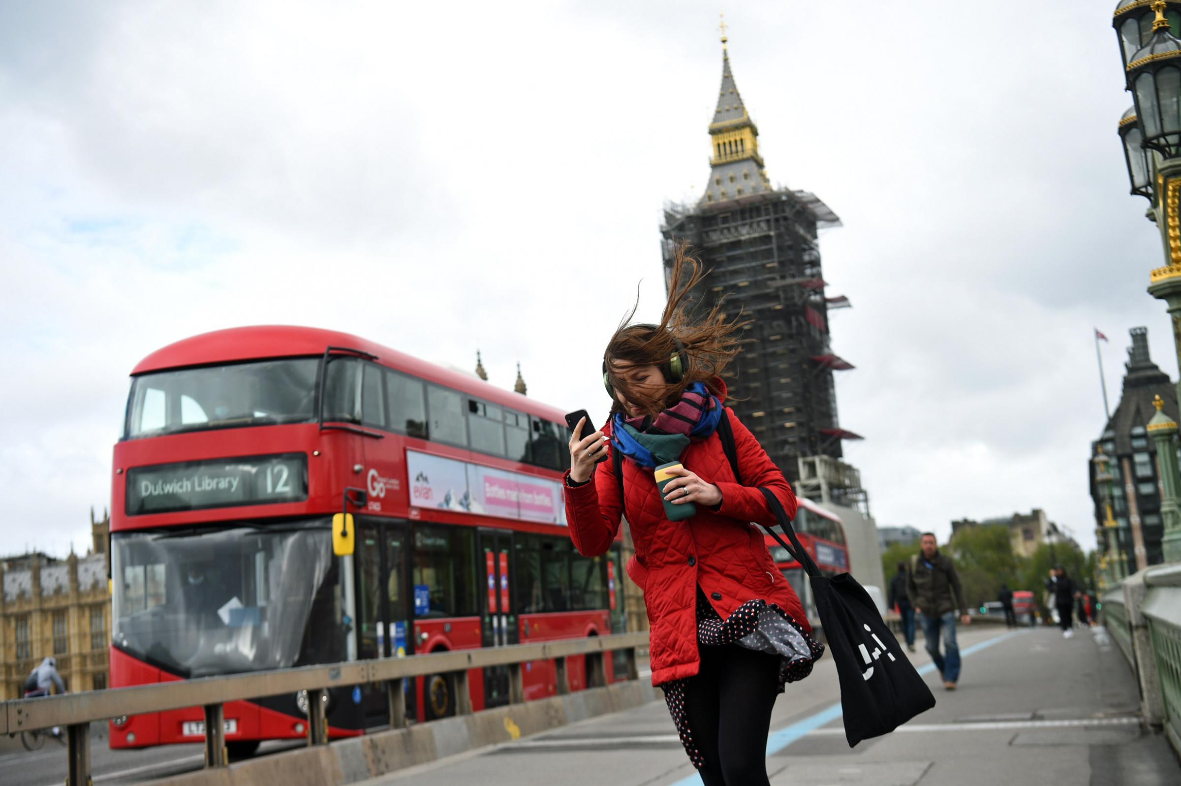
A woman buffeted by the wind whilst crossing the Westminster Bridge, London. Kirsty O'Connor/PA Wire
In London, rain and wind are expected across the weekend. Forecasts for the rest of the day (BBC Weather) predict 'gusty winds and rain showers', with a 71% chance of rain.
Light rain and slightly gentler winds are expected on Saturday, May 22, before "light rain showers and a moderate breeze" is forecast in London on Sunday.
There is also a possibly of thunder and lightning forecast on Monday, before some brighter, even sunny weather looks to poke through towards the end of next week.
Daytime temperatures are set to be low for the time of year, with the mercury expected to rise to around 14C London, and 12C in Edinburgh, Cardiff and Belfast.
Night-time temperatures are predicted to sit around the mid single figures.
A blustery night with hill snow on the mountains in Scotland is due to follow into Saturday, with more wind and rain across the board to follow.
Sunday is set to be slightly more promising, with showers again expected across the nation but longer dry, bright spells moving in.
Forecasters have said northern Scotland and Northern Ireland are likely to see the best of the sunshine on Sunday.


Comments: Our rules
We want our comments to be a lively and valuable part of our community - a place where readers can debate and engage with the most important local issues. The ability to comment on our stories is a privilege, not a right, however, and that privilege may be withdrawn if it is abused or misused.
Please report any comments that break our rules.
Read the rules here